- Bohol
- Bohol Travel
- Bohol Geography
Exploring Bohol Geography: From Chocolate Hills to Pristine Forests

Secure your Cebu Bohol ferry tickets today to start your unforgettable journey!
Bohol Geography
Bohol is an island province located in the central part of the Philippines. It is surrounded by other important islands like Cebu, Leyte, and Mindanao.
The Cebu Strait separates Bohol from Cebu, although both places share a similar language called Cebuano. However, Boholano, the dialect spoken in Bohol, still has its own unique identity.
The climate in Bohol is generally dry, with the rainy season occurring between June and October. The interior areas of the island are cooler compared to the coastal regions.
Bohol is the tenth largest island in the Philippines, covering an area of 4,821 square kilometers. It has a coastline that stretches for 261 kilometers.
Surrounding the main island are around 70 smaller islands, with Panglao Island being the largest and located southwest of Tagbilaran, the capital city, and Lapinig Island situated in the northeast.
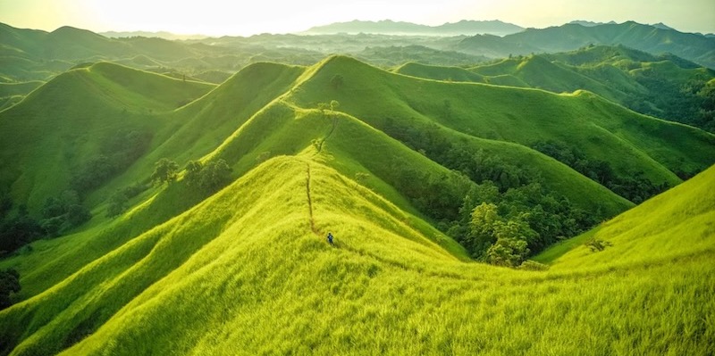
Chocolate Hills
The terrain of Bohol geography is characterized by rolling hills and valleys, and about half of the island is covered in limestone.
Near the outer parts of the island, you can find low mountain ranges. In the interior, there is a large plateau with various irregular landforms.
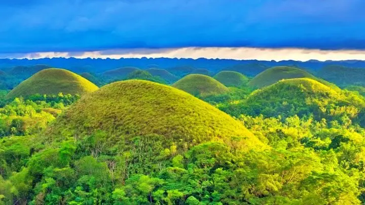
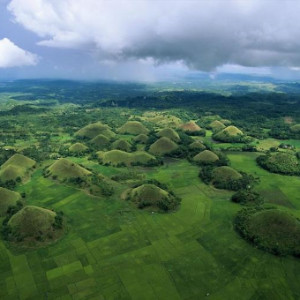
One of the most famous natural wonders in Bohol is the Chocolate Hills. Located near Carmen, these hills are more than 1,200 cone-shaped formations covered in grass that turns brown during the summer, resembling chocolate mounds.
They are made of limestone that was left behind from coral reefs when the island was still underwater during the Ice Age. The Chocolate Hills are considered a treasure of the Philippines and are even depicted on Bohol's provincial seal.
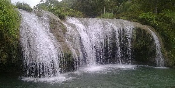
Bohol Geography: abundant water resources
Bohol geography is also known for its abundant water resources. There are 114 springs, 172 creeks, and four main rivers that flow through the province.
The largest river is the Inabanga, which can be found in the northwestern part of Bohol.
Other important rivers include the Loboc River in the central area, the Abatan River in the southwest, and the Ipil River in the north.
Additionally, Cabilao Island features the only natural lake in the province, known as Cabilao Island Lake or Lake Danao.
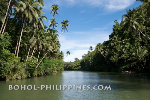
waterfalls & Rajah Sikatuna Protected Landscape
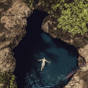
The Bohol geography is dotted with numerous waterfalls and caves, offering breathtaking sights.
One of these waterfalls is Mag-Aso Falls in Antequera, which is known for creating a mist in the mornings due to its cool waters. This mist can sometimes make the falls appear as if they are surrounded by smoke.
In the southern part of Bohol, near Bilar, you can find the Rajah Sikatuna Protected Landscape. This protected area safeguards Bohol's largest remaining lowland forest, providing a sanctuary for various plants and animals.
Bohol's geography offers a diverse and picturesque environment, making it a truly remarkable destination to explore and appreciate the wonders of nature.
Recommended Bohol Philippines Tours
[ Bohol Sight Seeing Day Trips - Check Out Availability ]
[ Full Day Cruise and Sailing Tours - Check out Availability ]
[ Full Day Adventure Tours - Check out Availability ]
Discover more of Bohol's natural wonders through our recommended tours. Click on the links below to embark on unforgettable adventures:
Ready to explore the beautiful islands of Cebu and Bohol? Secure your ferry tickets today through 12go and start your unforgettable journey!
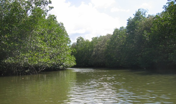
Bohol Geography: Rivers of Bohol
Bohol, a province in the Philippines, is blessed with several rivers that add to the natural beauty and richness of the region. Here are some of the notable rivers in Bohol geography, listed by their length:
1. Inabanga River: Stretching through the northwestern part of the province, the Inabanga River is the longest river in Bohol. It originates from the central mountain range and flows towards the Inabanga Bay. The river is known for its scenic landscapes, lush vegetation, and diverse wildlife.
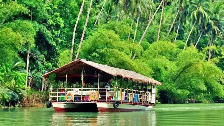
2. Loboc River: Located in the central part of Bohol, the Loboc River is a popular destination for river cruises and floating restaurants. It is known for its emerald-green waters and captivating surroundings. Visitors can enjoy a leisurely boat ride while admiring the picturesque views of the riverbanks.
3. Abatan River: One of the three main rivers of Bohol, the Abatan River flows through the towns of Antequera to Balilihan and opens up to the Cortes nipa swamps. It offers a unique opportunity to explore the cultural heritage and ecological wonders of the area. The Abatan River Community Life Tour takes visitors on a journey through lush greeneries, mangrove forests, and vibrant local communities.
4. Soom River: Situated in the northeastern part of Bohol, the Soom River is a smaller river that adds to the natural charm of the region. It meanders through scenic landscapes, providing a serene ambiance for those who visit.
These rivers not only contribute to the scenic beauty of Bohol but also play a crucial role in the ecosystem by providing habitats for various plants and animals. Exploring these rivers allows visitors to connect with nature, appreciate the importance of conservation, and witness the cultural and ecological diversity that Bohol has to offer.
Bohol Geography: The Stunning Islands of Bohol
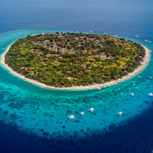
Bohol, an island province in the Philippines, is not only known for its captivating mainland but also for the 85 enchanting outlying islands that surround it.
These islands, under the jurisdiction of the Bohol Provincial Government, offer unique experiences and breathtaking natural beauty. Let's explore some of the more important islands that make up this archipelagic paradise.
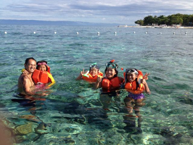
One of the must-visit islands is Balicasag, a small but incredibly scenic island. Known for its vibrant coral reefs and diverse marine life, Balicasag Island is a haven for snorkelers and divers. Immerse yourself in the crystal-clear waters and marvel at the colorful coral formations and the mesmerizing dance of tropical fish.
Cabilao Island is another gem in Bohol's island crown. With its pristine white sandy beaches and turquoise waters, Cabilao is a paradise for beach lovers. The island is also famous for its exceptional diving spots, where you can encounter majestic sea turtles, vibrant sea fans, and an abundance of marine species.
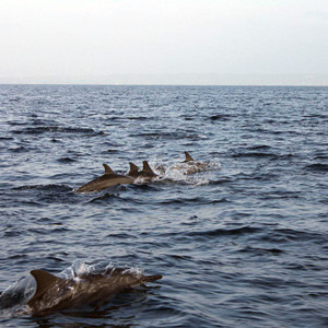
Pamilacan Island, located off the southwestern coast of Bohol, is a sanctuary for marine mammals. Here, you have the chance to spot dolphins and even whales during their migration season. Take a boat tour around the island and witness these magnificent creatures in their natural habitat, creating memories that will last a lifetime.
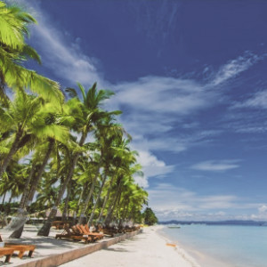
Panglao Island, the most well-known among Bohol's outlying islands, offers a mix of stunning beaches and vibrant nightlife. With its powdery white sand and crystal-clear waters, Alona Beach is a favorite destination for sunbathers and water sports enthusiasts. Panglao Island also boasts a lively nightlife scene, with beachfront bars and restaurants where you can enjoy live music and delicious local cuisine.
These are just a few examples of the remarkable islands that Bohol has to offer. Each island possesses its own unique charm and attractions, from secluded coves to hidden caves waiting to be explored. Whether you seek relaxation on pristine beaches, thrilling underwater adventures, or encounters with fascinating marine life, Bohol's islands have something for everyone.
Bohol Geography: Tarsiers of Bohol
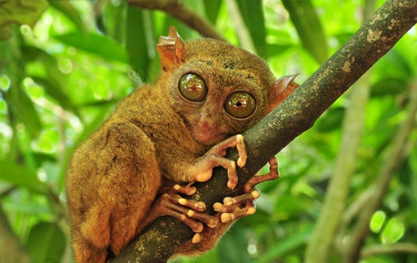
Tarsiers, fascinating creatures with their large eyes and unique adaptations, have found a sanctuary in Bohol, Philippines.
In 1996, the Philippine Tarsier Foundation was established in Corella, Bohol, with the aim of conserving and protecting these small primates and their natural habitat.
The Philippine tarsier, scientifically known as Tarsius syrichta, is the smallest living primate found in several Southeast Asian countries, including the Philippines.
In Boholano, the local dialect of Bohol, it is called "mamag." Sadly, the Philippine tarsier is considered near-threatened according to the IUCN Red List of Endangered Species.
The conservation efforts in Bohol play a vital role in preserving the tarsiers and raising awareness about their conservation needs.
Through responsible tourism and education, visitors have the opportunity to appreciate the beauty and uniqueness of these captivating creatures while contributing to their long-term survival.

Bohol Geography: Bohol Climate
Bohol geographically experiences different climate patterns throughout the year.
The northeast monsoon, known as "amihan," prevails from November to April. This period is generally mild and pleasant, with daytime temperatures averaging around 28 °C (82 °F). Nights are relatively cooler, with temperatures hovering around 25 °C (77 °F). Rainfall during this time is minimal, with occasional showers.
The summer season in Bohol spans from May to July. During this time, temperatures rise, and the days become hotter and more humid. It's important to stay hydrated and take precautions to protect against the sun's heat.
From August to October, the southwest monsoon, known as "habagat," influences the weather in Bohol. The weather during this season can be unpredictable, with a mix of calm days and rainy periods.
It's common to experience weeks of calm weather followed by days of heavy rainfall. While rain can occur throughout the year, the chances of encountering heavier showers are higher from November to January.
Overall, Bohol has a tropical climate, characterized by warm temperatures throughout the year. It's advisable to check the weather forecast before visiting and be prepared for potential rain showers by carrying a raincoat or umbrella.

Bohol Geography: Geologic Formation
The geological formation of Bohol dates back millions of years ago, during the Late Jurassic Period, around 160 to 145 million years ago. At that time, the majority of the island was still underwater, with only Mt. Malibalibod in Ubay and its nearby area in Alicia emerging above the sea.
Around 66 million years ago, during the end of the Cretaceous Period, the northern part of Bohol began to gradually rise.
Volcanic activity played a significant role during this time, leading to the deposition of multiple layers of volcanic rock across the region.
As landmass increased, Bohol's geology started to take shape during the Paleogene Period, around 60 million years ago. Diorite, an igneous rock, was introduced into the Talibon area during this period.
Between the Eocene and Oligocene epochs, Bohol's geological development paused for millions of years.
However, during the Miocene epoch, approximately 23 million years ago, the island's geologic evolution resumed.
Uplift and volcanic activity contributed to the deposition of limestone and the emergence of andesite, another volcanic rock. At this point, only the eastern half of the island was above water.
Around 5 million years ago, the southeastern portion of Bohol started to rise from the ocean, gradually revealing more of the island's landmass.
From the late Pliocene to the Pleistocene, approximately 3.6 to 1.8 million years ago, the remaining submerged areas of Bohol emerged, shaping the island into its present form.

Bohol Geography: Demographics Growing Island
Bohol, a province located in the Philippines, has witnessed significant changes in its population over the years. By examining the population census data, we can gain insights into the demographic trends and growth of this captivating island.
At the start of the 20th century in 1903, Bohol had a population of 269,223. Over the following decades, the province experienced a steady increase in population. By 1918, the population had risen to 358,387, reflecting a growth rate of 1.93% per year.
During the 1960s, Bohol saw a slight decline in its population growth rate, with a more modest increase of 0.57% per year. The population in 1960 stood at 592,194. However, this slowdown was temporary, as the province experienced a resurgence in growth in the following decades.
The 1990s brought significant changes to Bohol's demographics. The population soared to 948,403 in 1990, indicating a growth rate of 1.64% per year. Despite a slight decrease in the growth rate during the mid-1990s, with a 0.89% increase per year, the population continued to expand. By 2000, the population had surged to 1,139,130, with an impressive growth rate of 2.95% per year.
In the following years, Bohol's population growth rate stabilized, reflecting a more moderate increase. The 2007 census reported a population of 1,230,110, with a growth rate of 1.07% per year. By 2010, the population had reached 1,255,128, reflecting a growth rate of 0.74% per year. The 2015 census showed a population of 1,313,560, with a growth rate of 0.87% per year.
According to the latest available data from the 2020 census, Bohol's population had further increased to 1,394,329. This reflects a growth rate of 1.18% per year, indicating that the province continues to experience population growth.
The changing demographics of Bohol paint a picture of a province on the rise. With a growing population, Bohol attracts not only locals but also visitors who are captivated by its natural wonders and rich cultural heritage. The province's evolving demographics shape its social, economic, and cultural landscape, providing opportunities and challenges for its residents and policymakers alike.

remarkable geography of Bohol
And let's not forget about the remarkable geography of Bohol itself. The island is characterized by rolling hills, limestone formations, and captivating landscapes. The world-famous Chocolate Hills, located in the town of Carmen, are a unique geological wonder. These symmetrical mounds, covered in lush greenery, turn brown during the dry season, resembling chocolate kisses scattered across the land.
Bohol's geography also includes winding rivers, dense forests, and picturesque waterfalls. The Loboc River, for example, offers a serene and scenic cruise, allowing you to immerse yourself in the tranquility of the surrounding nature. Mag-Aso Falls in Antequera showcases the power and beauty of cascading waters amidst a lush tropical setting.
As you venture through these island treasures and explore the remarkable geography of Bohol, remember to respect their delicate ecosystems and follow sustainable tourism practices. By preserving the natural beauty of these islands and the mainland, we can ensure that future generations will continue to be captivated by their splendor.
So, pack your bags, grab your snorkeling gear, and get ready to discover the extraordinary islands and geography of Bohol. Your island adventure awaits!
Ready to explore the beautiful islands of Cebu and Bohol? Secure your ferry tickets today through 12go and start your unforgettable journey!
recommended hotel booking
Book your stay in Bohol's breathtaking surroundings through Agoda and experience the ultimate relaxation
Top 25 Sights and Attractions in Bohol
- Chocolate Hills
- Tarsier Conservation Sanctuary
- Panglao Island
- Loboc River Cruise
- Hinagdanan Cave
- Balicasag Island
- Alona Beach
- Bilar Man-made Forest
- Blood Compact Shrine
- Baclayon Church
- Bohol Bee Farm
- Anda Beach
- Sipatan Twin Hanging Bridge Loboc
- Danao Adventure Park
- Sagbayan Peak
- Butterfly Conservation Center
- Clarin Ancestral House
- Dimiao Twin Falls
- Mag-Aso Falls
- Anda White Beach
- Lamanok Island
- Rajah Sikatuna Protected Landscape
- Dauis Church
- Can-umantad Falls
- Punta Cruz Watchtower
Top 20 Destinations of Bohol
- Tagbilaran City
- Panglao Town
- Talibon Town
- Anda Town
- Loboc Town
- Dauis Town
- Ubay Town
- Tubigon Town
- Loon Town
- Jagna Town
- Alicia Town
- Carmen Town
- Getafe
- Danao Town
- Bilar
- Alburquerque
- Sierra Bullones
- Sagbayan Town
- Baclayon Town
- Antequera
Ready to explore the beautiful islands of Cebu and Bohol? Secure your ferry tickets today through 12go and start your unforgettable journey!
All Rights Reserved ©2023. Bohol Philippines Travel Guide
Address: Talibon, Bohol, Philippines
